High
Resolution Satellite Imagery can be facilitated through FullHouse.
Satellite
Images can be extremely effective for planning and development
purposes, interactive websites and CD presentations, general
marketing or high-resolution prints.
Minimum
areas of imagery are 8km X 8km for tasking and 5km X 5km for
archive imagery. Contour overlays are available throughout Southern
Africa up to 1metre of accuracy. A 3d fly through can be produced
to provide an accurate representation of the land area imaged.
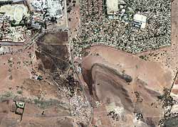
The
following image is a 1:50 000 scale and is zoom able to 1 :
800
Click on image to Enlarge
Contact
chris@fullhouse.co.za
for more information.